


Change in building design: from drawing board to BIM
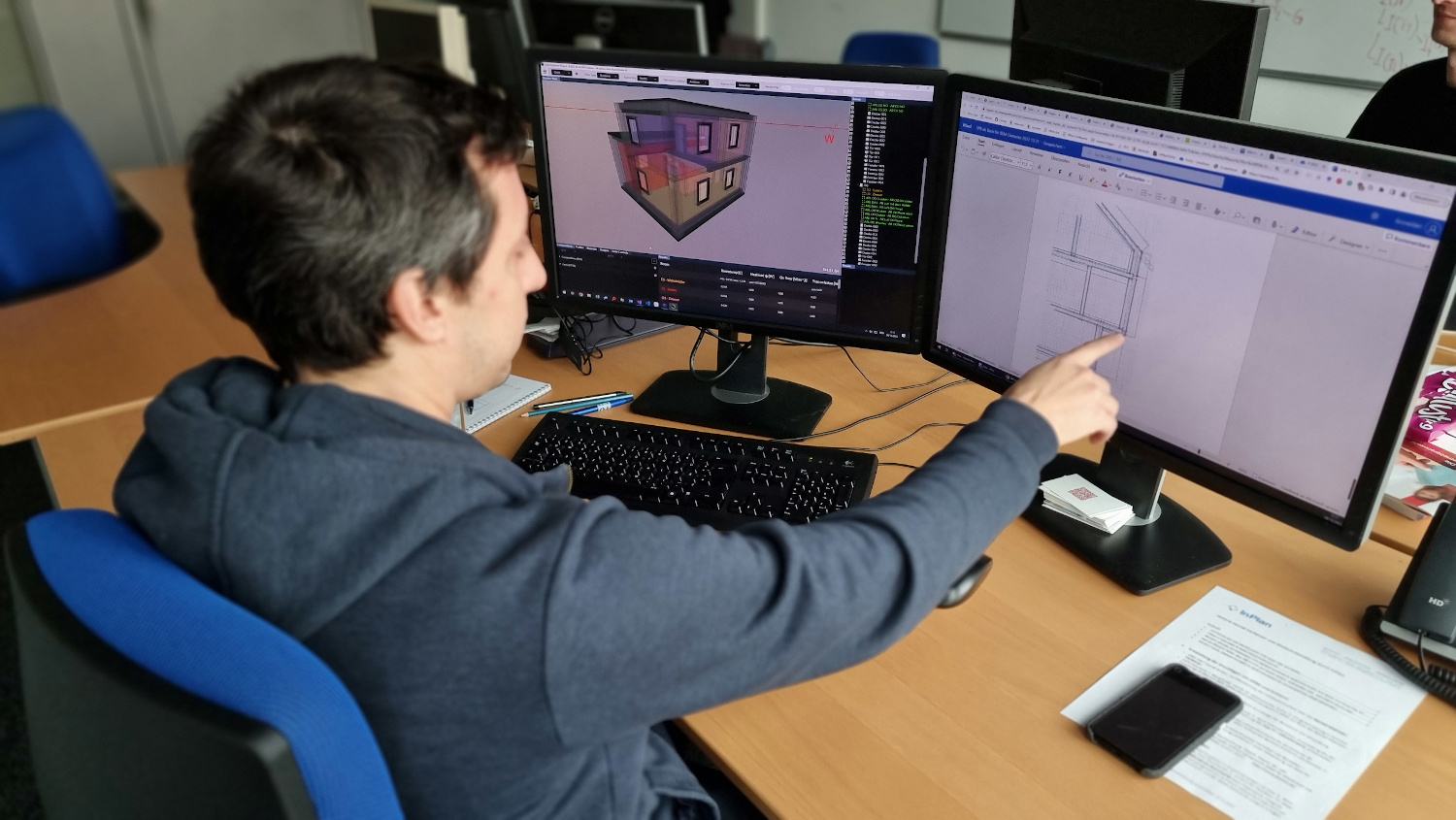
Since the introduction of CAD technologies, the building design industry has been transforming from drawing boards to digital systems. As a result, buildings and technical building equipment are increasingly being created in 3D software programs. In the process, a lot of data is generated by the numerous planning participants from architecture, building physics, statics, and planning of the technical building equipment. In order to centralize this diverse data and to be able to use it more efficiently, Building Information Modeling (BIM) is becoming more and more prevalent with the help of the ifc data format. In the course of the planning and execution phases of a building, a digital twin is created with the help of BIM, so that the building can be visualized for operational management and the decisive operational data can be clearly retrieved.
Energy-efficient planning in conjunction with BIM and digital twin
An essential factor in addressing the climate crisis is the efficient use of energy to condition buildings. To combine energy-efficient planning with BIM and digital twins, VRVis and InPlan are researching a new software tool, which integrates simulation algorithms into the BIM world and casts them into a handy digital tool. This tool supports planners in all aspects of energy efficiency and HVAC (heating, ventilation, and plumbing) during the planning process. The digital building twin not only contains data but also clearly shows the dynamic behavior on cold winter days or during hot spells. The focus of the planned software package is on standard-compliant designs that ensure comfortable temperatures on the coldest winter days on the one hand and the summer suitability of buildings on the other. These calculations are part of the daily planning routine of building physicists and building services planners. The project represents an important research contribution to raise the planning quality of energy planners and to further increase the energy efficiency of buildings. The project was awarded the eAward in the category "Smart Data" in 2023.
The visualization and simulation tool provides a solution for various aspects of interactive real-time energy planning:
Area Coordinator Smart Worlds & Head of GeoSMAQ, Geospatial Visualization, Semantic Modelling, and Acquisition Group
traxler(at)vrvis.at +43 1 908 98 92 520
The research goal of AMASE is to create a suite of tools and methods to ingest, process, visualize, and manipulate heterogeneous, large-scale geospatial data. This data is the constantly updated representation of the real world in the form of an evolving digital twin.

Together with Rhomberg Bau GmbH and convex ZT GmbH, VRVis is developing a concept for the use of Boston Dynamic's robot dog "Spot" for autonomous, immersive construction site documentation.

The main goal of this project is to enable a reliable decision support for large-scale infrastructure projects by providing solutions for a collaborative visual analysis of digital twins.

For many years we have been dealing with all aspects of hydrodynamic modelling. With our software viscloud we can model different scenarios and also offer this as a service.

The main objective of the strategic project ARCS is the design of software architectures that enable interactive visualization systems to ingest large volumes and velocities of geospatial and associated non-geometric data.

We create a digital twin of a community and simulate weather events to identify high-risk buildings and infrastructure vulnerabilities.