
This is because large-scale changes in the landscape and climatic changes can be easily tracked using remote sensing. Remote sensing is based on freely available satellite data, such as those provided by the Landsat missions or ESA's Copernicus program. However, the quality of the results for smaller areas is still low. This is due to the relatively large sampling rate of the land. This is relevant for Austria, among others, because about one third of the agricultural area here is fractured and small-structured and therefore no precise analysis with satellite data is possible.
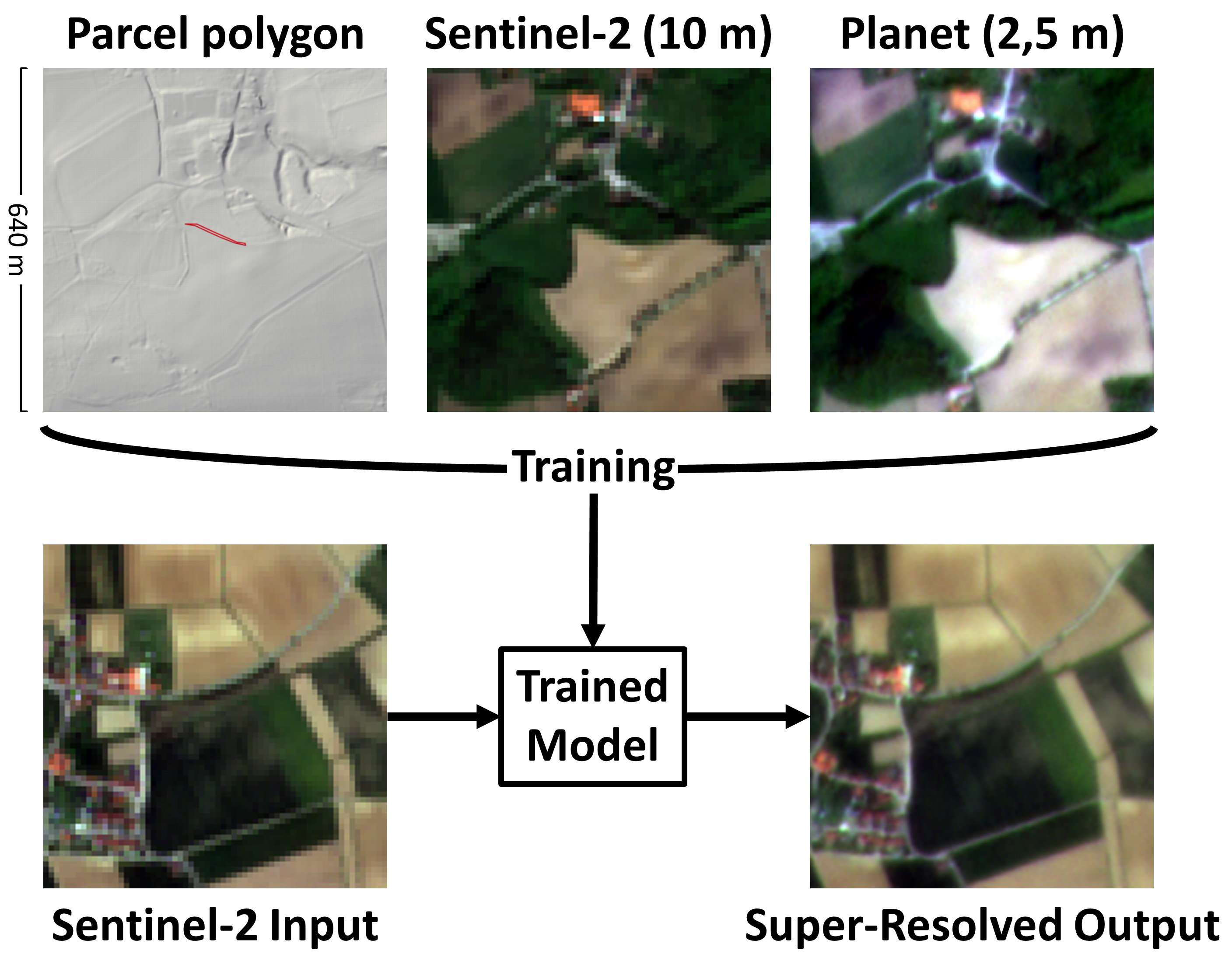
The European Green Deal aims at making agricultural production more sustainable within the EU. A reliable digital monitoring of all areas can ensure effective climate protection, as well as the conservation of natural resources and the biodiversity. Together with Agrarmarkt Austria (AMA), EOX IT Services GmbH and the Department of Geoinformatics - Z_GIS at Paris Lodron University Salzburg, VRVis is working on innovative visualization solutions that use Super-Resolution Reconstruction (SRR) to provide high-quality analysis even for small areas. Thus, the project named SMAIL promotes the digitization of agriculture vastly. SMAIL is currently the only project in the EU using AI-based super-resolution of Sentinel-2 data.
AI ensures increased image resolution
Digital analysis of agricultural territories promotes sustainable development
SRR-based monitoring of agricultural land, as SMAIL is working on, has the potential to provide a sound basis for decision making in the context of environmental sustainability, both locally and globally. Furthermore, the project contributes to enhance the digitization of agricultural land use.
Further information
Vienna, August 3 2023
Senior Researcher & Project Leader, Integrated Simulations
cornel(at)vrvis.at