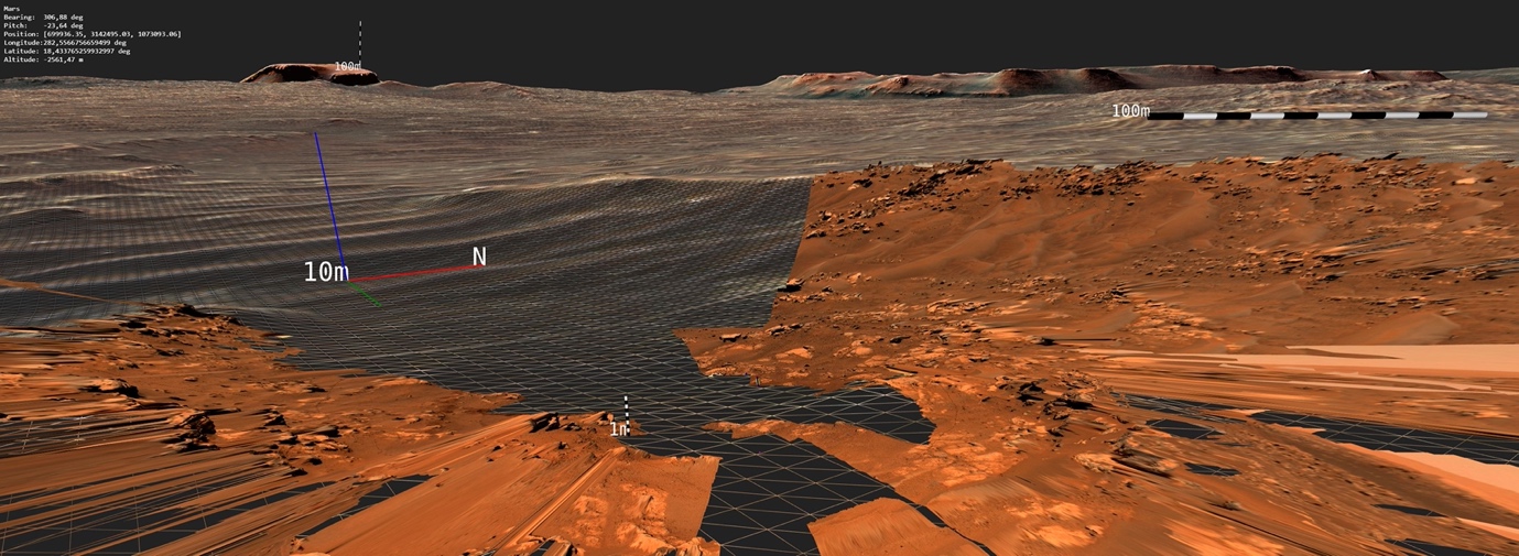
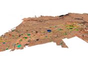
PRo3D supports planetary researchers on NASA and ESA missions to find signs of life on the red planet by examining high-resolution 3D surface reconstructions from orbiter and rover cameras. PRo3D is part of the current NASA Mars mission. Over the last 5 years, the development of PRo3D has been aimed at providing planetary geologists with interactive tools to digitize geological features on digital exposure models (DOMs) on the surface of Mars. During our successful collaboration with the Imperial College of London, PRo3D has proved to be the researchers' main tool for conducting remote geological analyses, leading to many publications and lectures in various places of geological science.
Planetary geology is the most promoted use case of PRo3D, but we are trying to extend our user groups to other use cases, so we have also developed features to support scientific objectives in landing site selection and mission planning.
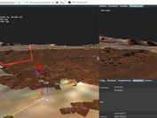
3D Layers
Planetary Science
Large amounts of data
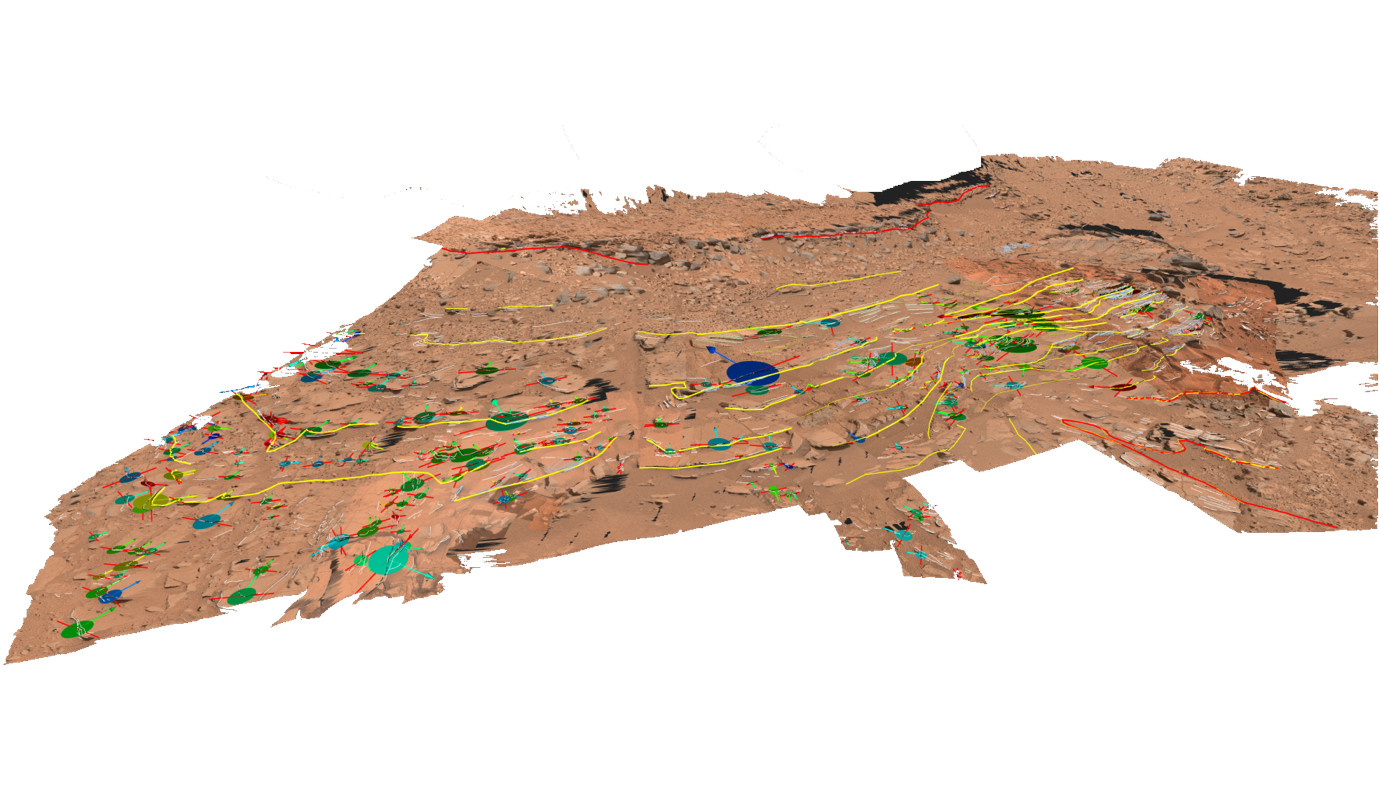
Geological Annotation
The Mastcam-Z team's first 3D video flyover of the Martian surface. The video shows the immediate environment of NASA's Perseverance rover, compiled from Mastcam-Z flight stereo images.

Prof. Sanjeev Gupta is Co-Investigator on the Mastcam camera teams on the Mars Science Laboratory Curiosity rover mission in Gale crater on Mars, Collaborator on the Mastcam-Z camera team of NASA Mars 2020 rover mission, which landed successfully on Mars in 2021 as well as Co-Investigator on the PanCam camera team of the ExoMars 2020 rover mission, which is currently planned for 2028.
PRo3D is available for download at pro3d.space including reconstructions of the Martian surface to try out. PRo3D is also available in open-source form on Github. For academic or commercial inquiries please contact science(at)vrvis.at.

In the PROVEX project, JOANNEUM Research and VRVis are developing a provenance-aware workflow management tool for heterogeneous data for use in ESA's HERA mission.

WIBSTAC addresses the usage of wide baseline stereo 3D reconstruction for medium- and long-range mapping of the Martian surface, based on imagery from panoramic rover camera instruments.

PanCam-3D focuses on the further development of interactive 3D visualizations for the ExoMars 2022 mission.

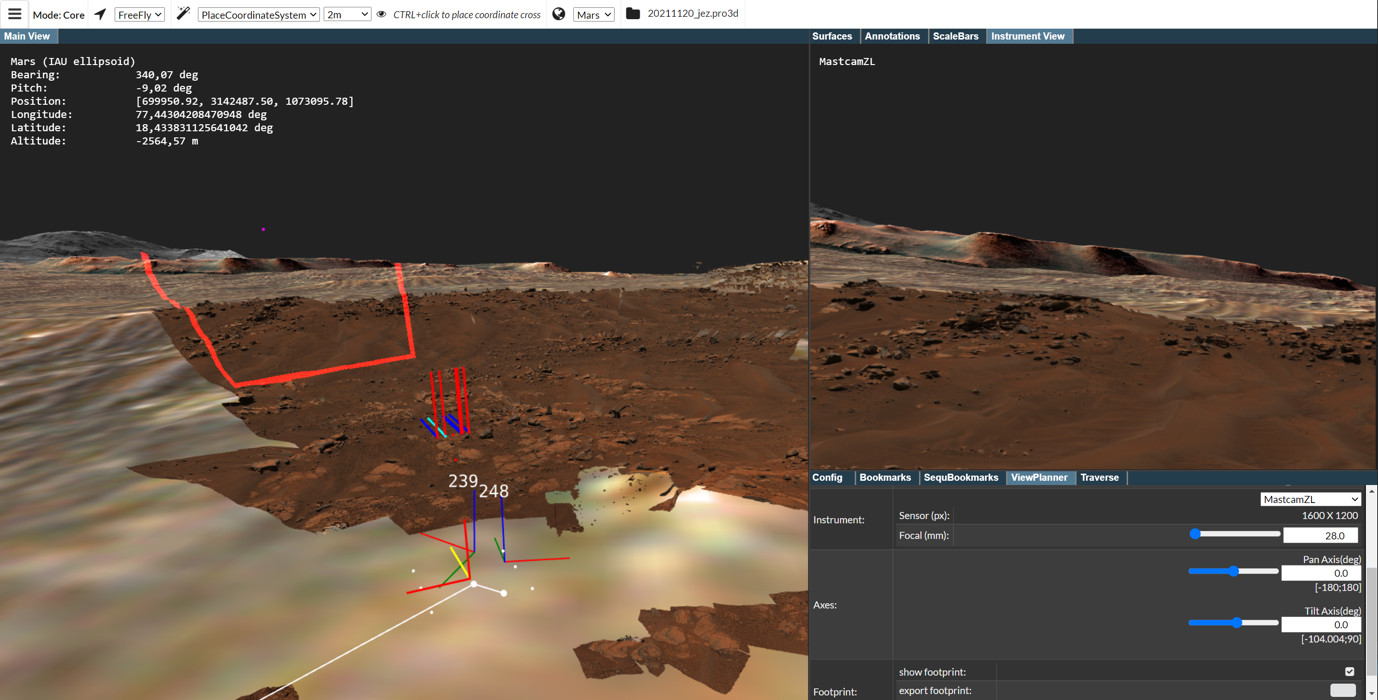
Support for planetary research: Visual analysis of reconstructions of the Mars surface and view planning for rover camera instruments.

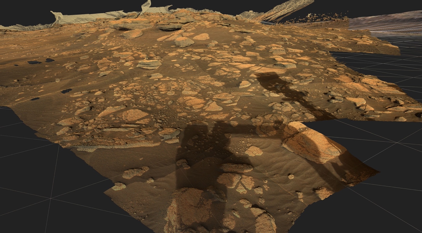
Virtual exploration and geological analysis of reconstructed Mars surfaces and rock outcrops.

Visual Analysis of Asteroid Deflection.

MINERVA is an integrated framework for planetary scientists allowing members of different instrument teams to cooperate synergistically in virtual workspaces by sharing observations, analyses and annotations of heterogonous mission data.

The "Mars-DL" project is investigating how a deep learning system can support the research work of planetary scientists through object and pattern recognition. For this project VRVis has extended the functionality of PRo3D to automatically render shatter cone training images.