


The GeoSMAQ research group focuses on methods for the creation, visualization, and interactive analysis of 3D geospatial data. Our use cases range from terrestrial surveying over digital planning and simulation to planetary science. With our work, we address three research directions:
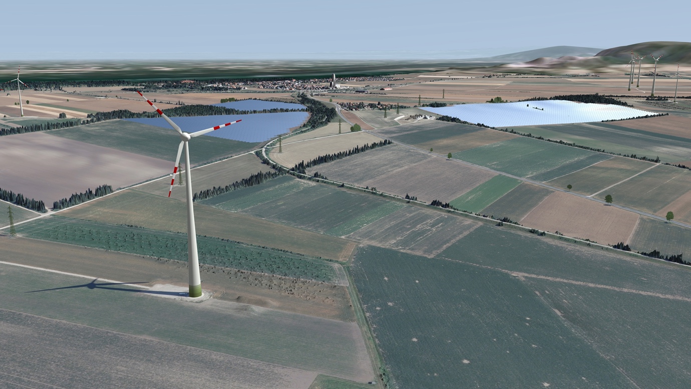
First, we want to make it easy to represent, visualize, and understand vast amounts of acquisition data, which are generated in increasingly high detail and increasing frequency with today's emerging technologies, such as high-resolution laser scanners or mobile mapping.
Second, we research methods to computationally understand these high-resolution data by deriving semantics giving us the opportunity to reduce the size of the data while simultaneously making it more meaningful. The simplified data we can enrich with simulations or senor measurements. Examples are thermal comfort simulation for energy planning, physically accurate light simulation for architectural design or digital twins for tunnel monitoring that also consider sensors.
Third, we want to build interactive systems integrating all relevant spatial and non-spatial information to support experts in planning, analysing, and making informed decisions.
Company partner: Clone:it, Dibit Messtechnik, EOX, ESA - European Space Agency, Geoconsult ZT, Geodata ZT, InPlan Ingenieure, NASA - Jet Propulsion Laboratory (JPL), ÖBB Infrastruktur, rmDATA, SLR Engineering, Zumtobel
scientific partner: Arizona State University, Austria Academy of Sciences (ÖAW), Imperial College London, Joanneum Research, University College London, Vienna University of Technology (TU Wien)
Area Coordinator Smart Worlds & Head of GeoSMAQ, Geospatial Visualization, Semantic Modelling, and Acquisition Group
traxler(at)vrvis.at +43 1 908 98 92 520Behind our smart solutions and software are smart and driven people. Do you want to meet the team?
Geospatial Visual Analysis
3D interaction methods
GPU accelerated visualization and computation
Processing of geographic data for real-time rendering
Support of BIM data from buildings and infrastructure
Semantic Modelling
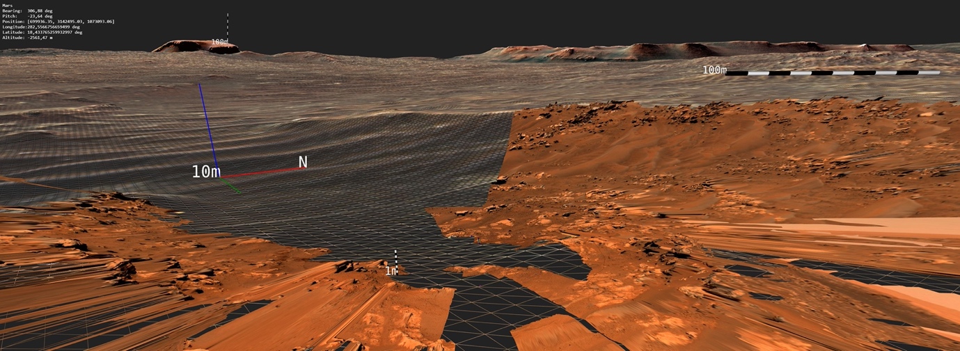
Planetary Science
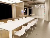
Interactive Light Simulation
Interactive thermal transfer simulation
Optimization of photogrammetry
AI based reconstruction and segmentation
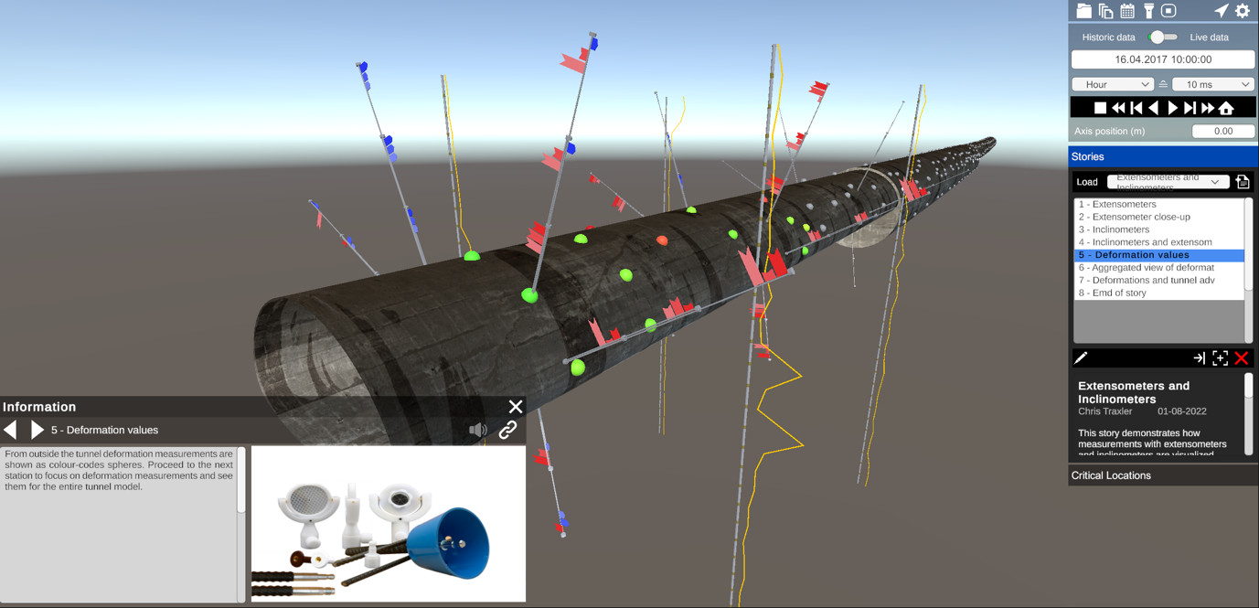
Digital Twin

Construction sites are highly dynamic places, which makes complete and convenient documentation all the more important. As part of the "AI5production" program, VRVis and rmDATA are investigating whether mobile devices with LiDAR and high-resolution cameras are suitable for automatically recording construction processes in 3D.

In the PROVEX project, JOANNEUM Research and VRVis are developing a provenance-aware workflow management tool for heterogeneous data for use in ESA's HERA mission.

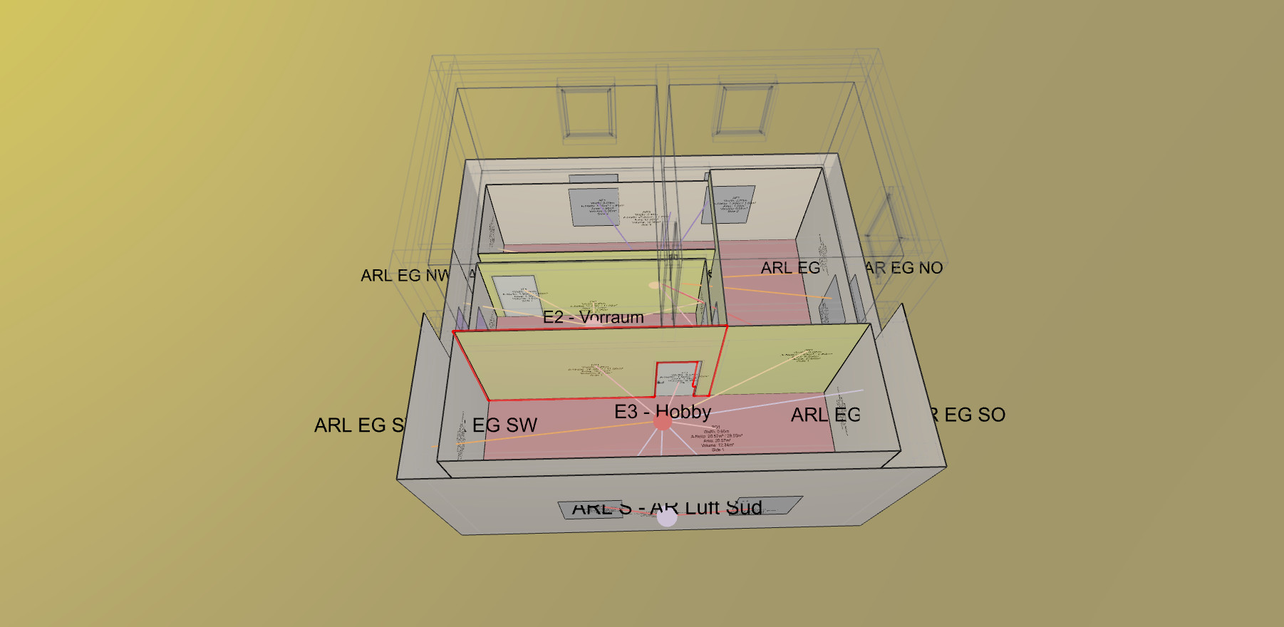
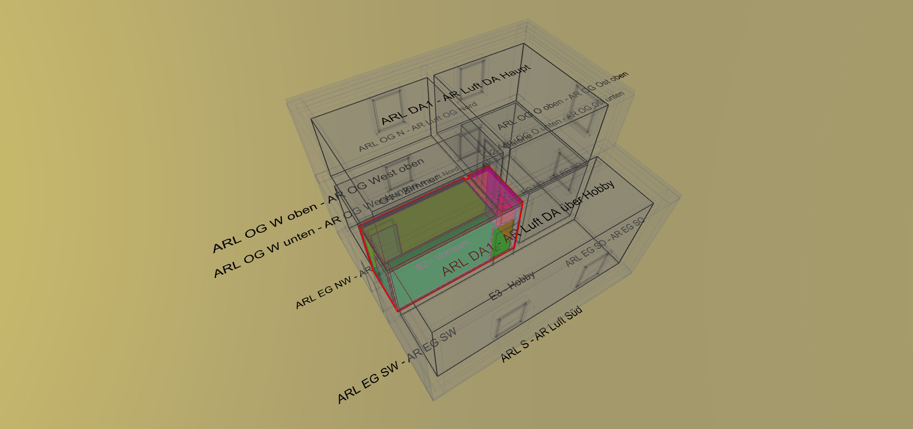
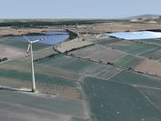
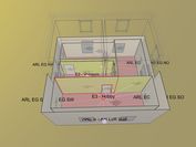
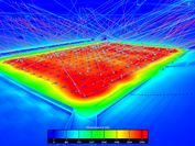
InPlan and VRVis develop a visualization and simulation package for energy planning of buildings, which enables intuitive optimization in terms of energy efficiency and comfort.

The Rail4Future project is focusing on the design of a digital rail system for the future. To this end, a novel and fully virtual validation platform for large-scale simulations of entire rail lines is being developed to increase the efficiency of existing rail infrastructure.

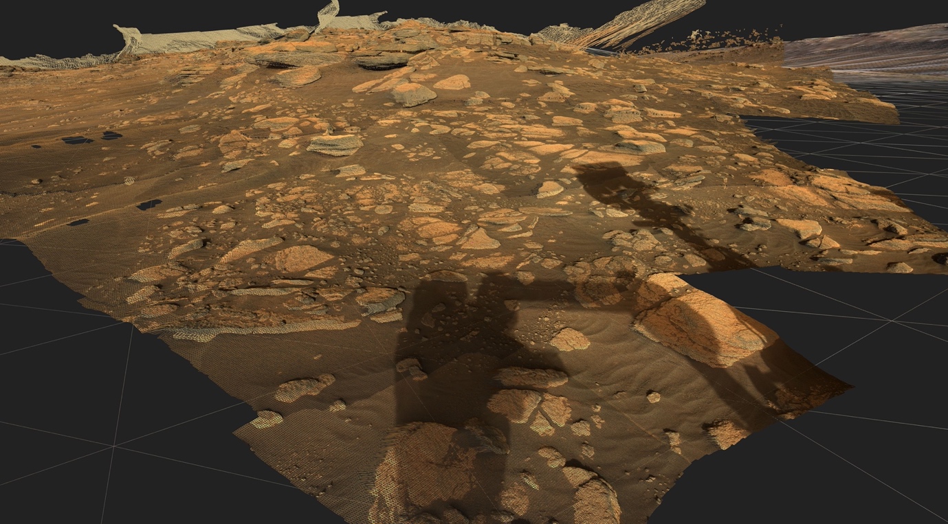
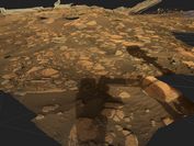
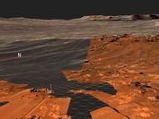
Virtual exploration and geological analysis of reconstructed Mars surfaces and rock outcrops.

PanCam-3D focuses on the further development of interactive 3D visualizations for the ExoMars 2022 mission.
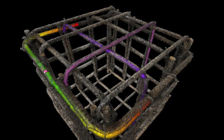
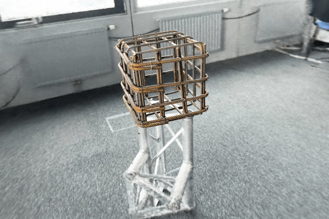
Digitization of construction sites: VRVis and clone:it automate rebar inspection and documentation.

With the help of 3D printing (additive manufacturing), spare parts for defective trains can be produced more easily and in a sustainable way as well as faster and cheaper - a great potential for the climate-friendly future of train transport companies.
The research goal of AMASE is to create a suite of tools and methods to ingest, process, visualize, and manipulate heterogeneous, large-scale geospatial data. This data is the constantly updated representation of the real world in the form of an evolving digital twin.

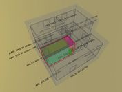
The main goal of this project is to enable a reliable decision support for large-scale infrastructure projects by providing solutions for a collaborative visual analysis of digital twins.

The main objective of the strategic project ARCS is the design of software architectures that enable interactive visualization systems to ingest large volumes and velocities of geospatial and associated non-geometric data.


Visual Analysis of Asteroid Deflection.

In this project we develop new methods from the field of visual analysis and machine learning to automate the quality control and quality assurance of glass articles.
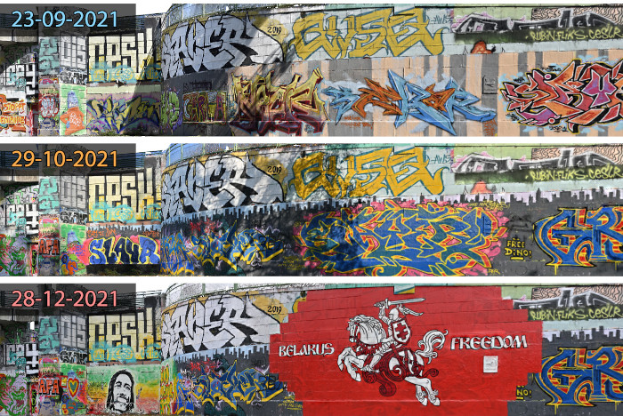
The INDIGO research team is systematically documenting the graffiti on Vienna's Donaukanal, using these photos to create a digital twin of the walls. VRVis is currently contributing its technological expertise to the project.

The "Mars-DL" project is investigating how a deep learning system can support the research work of planetary scientists through object and pattern recognition. For this project VRVis has extended the functionality of PRo3D to automatically render shatter cone training images.

Together with Rhomberg Bau GmbH and convex ZT GmbH, VRVis is developing a concept for the use of Boston Dynamic's robot dog "Spot" for autonomous, immersive construction site documentation.

WIBSTAC addresses the usage of wide baseline stereo 3D reconstruction for medium- and long-range mapping of the Martian surface, based on imagery from panoramic rover camera instruments.

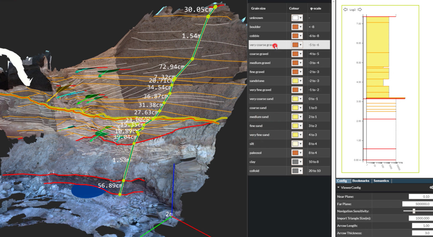
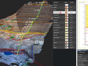
A visual tool for a combined stratigraphic and temporal documentation and interpretation of excavation projects.

Strategic Research in Scalable, Semantic Rendering.

Planetary Robotics Vision Data Exploitation.


MINERVA is an integrated framework for planetary scientists allowing members of different instrument teams to cooperate synergistically in virtual workspaces by sharing observations, analyses and annotations of heterogonous mission data.

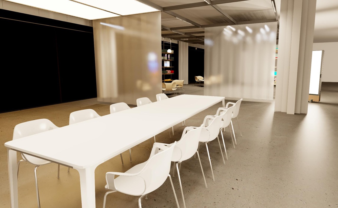
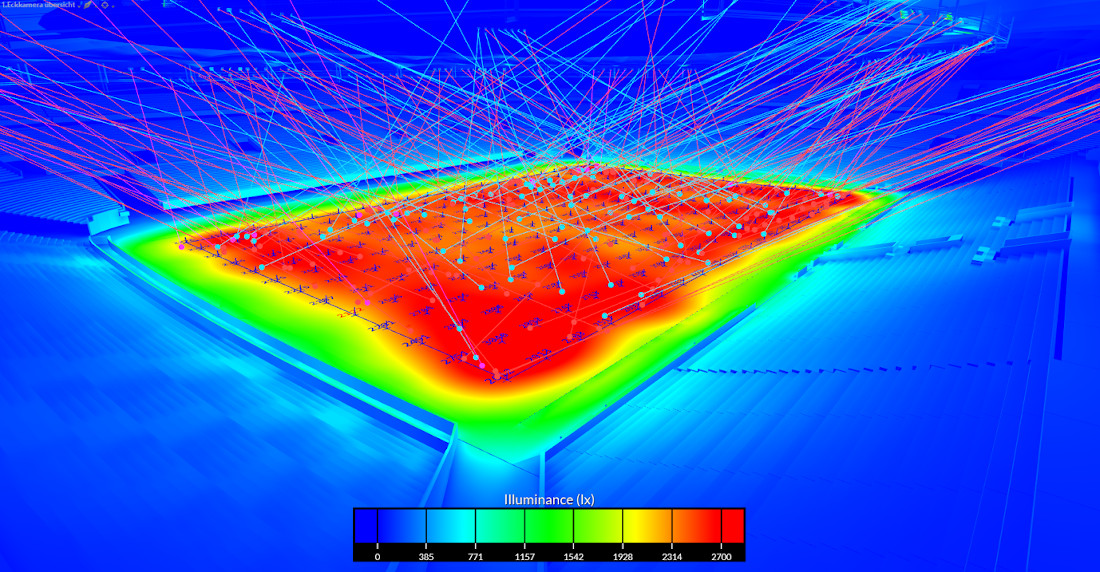
In this project tools and methods for handling, administration, manipulation and evaluation of several different data sources for measurements and lighting design are developed.

Research project on powerful visualization methods to support decision making in complex infrastructure projects, especially in tunnel, railway and road construction.

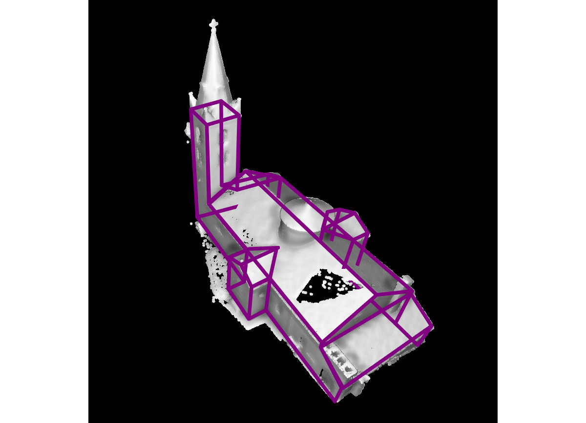
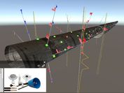
Visualization and visual analysis of high-resolution surface reconstructions find a wide range of applications, from tunnel monitoring and archaeological excavations to the change management of cultural heritage buildings.

Digital representations of the real world and digital twins are becoming increasingly important for planning, situation assessment and decision-making.

Investigation of techniques enabling a seamless analysis of data from multi-run simulations on multiple degrees of detail.
Seamless visual analysis of data involving 3D geometry, relational information and multivariate attributes.

Algorithms to improve the visual analysis of surface reconstructions.

High-quality lighting simulation requires dynamic, interactive, realistic real-time lighting simulation for various complex architectural environments.

Visual Analytics for Modeling and Simulation: Improvement of simulation setup and design scenarios with tools and methods of Visual Analytics.

Decision support systems and 3D viewing technologies for tunnel construction.