
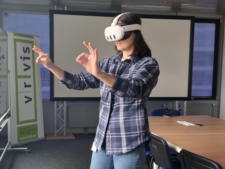
As the name of our company already states, we have been researching in the field of virtual, augmented and mixed reality since our foundation. Thanks to affordable hardware, these immersive technologies have arrived in the middle of society. Our research focuses span from immersive analytics to training and planning applications. In the research area of Immersive Analytics, we are looking for new solutions to overcome the barriers between people and their data. People live in a 3D world and are used to processing and interacting with 3D information. We use VR and AR technologies to visualize complex information - this simplifies data analysis and improves data understanding. The user stands in the visualization of his data, not just in front of it.
Another focus of our research is on VR training applications that enable users to immerse themselves in highly realistic environments and events, and to gain a sustainable learning experience. Virtual reality is the perfect tool to recreate scenarios that are otherwise too difficult or expensive to train "for real". This is especially true for scenarios that are dangerous for humans or their environment or are characterized by great scene complexity and special collaboration needs.
The third focus of our research area "Extended Reality" is planning. Planning processes are complex and error-prone. 3D visualizations in combination with virtual reality are the optimal basis for a better understanding of data as well as better communication about the project and its progress. Similarly, in the field of planning, we are researching the combination of Mixed Reality and BIM (Building Information Modeling). With the help of MR, we translate the three-dimensional, computer-based BIM building models into reality to optimize and enhance construction and planning processes. Through the additional use of Extended Reality, planning and engineering teams gain completely new perspectives by being able to view the 3D models detached from the screen and actually enter them in three dimensions. Along our company motto "He who sees, understands", an on-site model walk-through proves to be the best option to eliminate communication problems and construction obstacles.

Virtual Reality for military mission planning
The Austrian Armed Forces use a VR application developed by VRVis to plan maneuvers and operations around the world. Urban scenes are reconstructed in 3D from satellite images so that users can move freely within them: for training in local knowledge, for mission planning through to maneuver exercises or for planning rescue operations. This VR application is an important application for modern armed forces, as it offers several advantages at once: Complex geographic content is conveyed that cannot be transported on two-dimensional maps, operational areas are learned about "from a distance," and all operations in the simulation are documented for command generation and planning. More information about the project

Immersive tunnel monitoring in virtual reality
Tunnel safety is an important issue in the Austrian road and rail network. Teams of engineers monitor tunnels for cracks and irregularities during excavation, concrete construction and live operation. To support this work, we are researching digital tools for tunnel inspection at VRVis together with our partner Dibit Messtechnik. We have developed a virtual reality tunnel monitoring system in order to better perceive the real proportions of the tunnels and to gain new insights into the data through the immersion gained. This can also be used for the training of geologists, for example. More about the project.

Simulating Eye Diseases and Vision in Virtual Reality
Around the world, 2.2 billion people have a visual impairment or eye-related diseases. Due to our aging society, age-related visual impairments are also rapidly increasing and are becoming a fundamental topic for urban and interior planning, as well as architecture. Therefore, the research project "XREye" is dedicated to working together with ophthalmologists to simulate visual impairments such as macular degeneration or cataracts as realistically as possible in virtual and augmented reality. Read about the project

Augmented and Mixed Reality in the pharmaceutical industry
Pharmaceutical research and development is characterized by high quality requirements. In order to improve ongoing process development, an international pharmaceutical group relies on an augmented reality solution from VRVis. The AR solution is used in the laboratories for monitoring ongoing experiments and helps to optimize workflows through user guidance as well as enabling global collaborative working. More information about the project

Reconstruction of historic buildings, monuments and cultural heritage landmarks
Of all building structures, historic, landmarked buildings as well as landmarks are most at risk from the ravages of time. The VRVis uses drone imagery and 3D laser scans to reconstruct these architectural and cultural heritage landmarks using extended reality methods and make them experienceable in virtual reality. This serves the purpose of documentation and cultural mediation, in that even the smallest and finest facade elements or decorative elements can be depicted. These models also facilitate the documentation of facade changes, maintenance as well as predictive maintenance.

Virtual Reality for Life Sciences
The tools of Extended Reality – Augmented Reality (AR) and Virtual Reality (VR) – are being used more and more often in the Life Sciences. Digital Realities help enhance scientific experiments, trainings and procedures by creating cheap and controllable immersive environments true to reality.
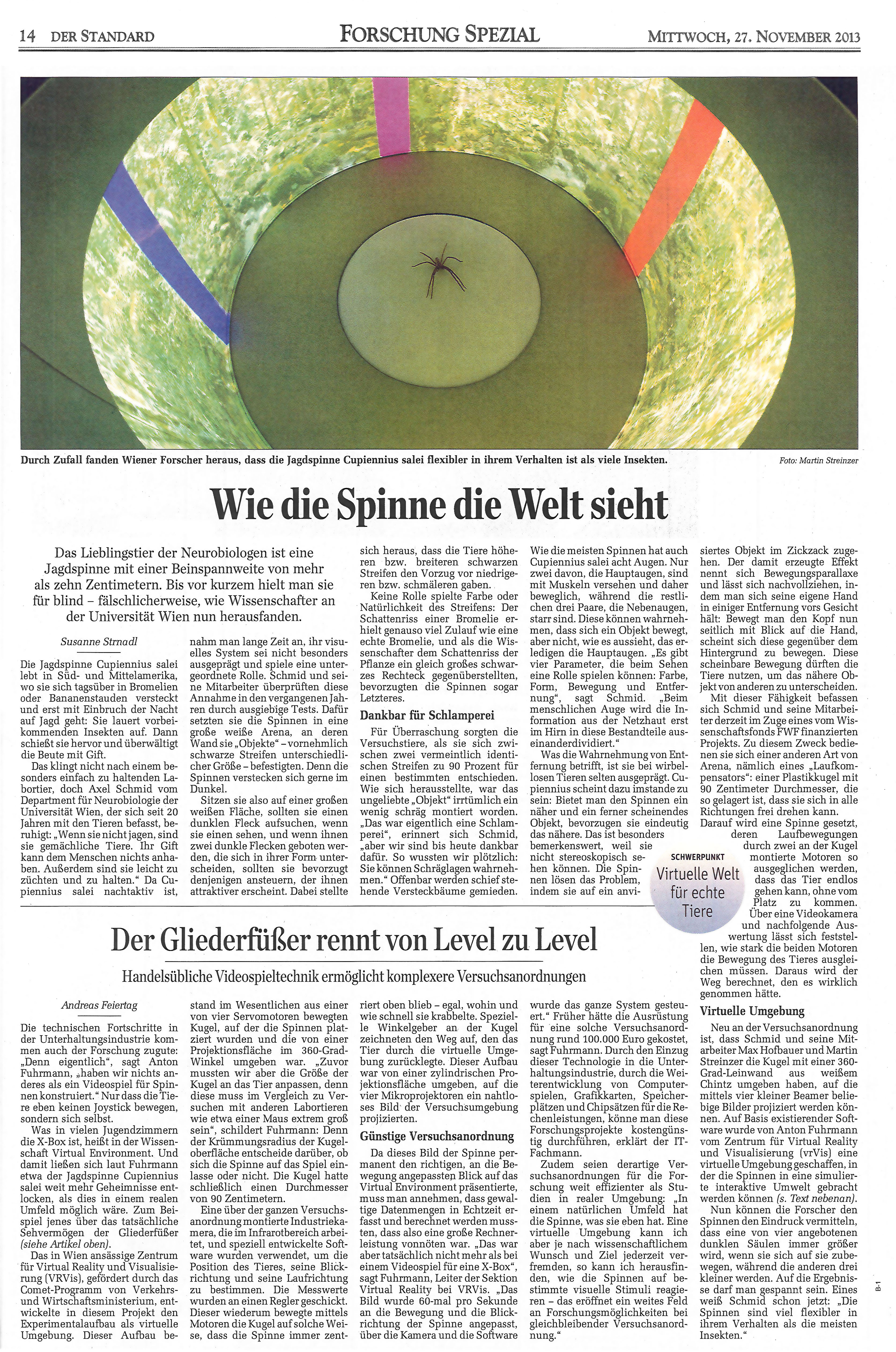
For the department of Neurobiology at the University of Vienna VRVis created a setup for the research into the reactions of hunting spiders. The spider moves on a ball of about one meter in diameter inside a projected virtual environment. A camera picks up on the movements and the ball is rotated accordingly, so that the spider always remains in the center of the setup. In this manner, various visual stimulations can be produced in correlation with spider movements, even ones, that would not be possible in a purely physical setup. Find more information in our Paper "Reverse Engineering Animal Vision with Virtual Reality and Genetics", our video "Reverse Engineering Animal Vision with Virtual Reality and Genetics" or in the press coverage in Der Standard.

VRVis has been developing extended reality solutions for better inclusion and accessibility for years. Together with HGBS-GmbH, a research team has now examined how people with visual impairments can be ideally supported by AR glasses. The involvement of affected people was central to the project.
Regular maintenance of the vehicles is necessary for safety in rail transport. When working on the train roof, technical personal might forget spare parts or tools. This can be dangerous when going at high speed. VRVis and Zugkraft-kN are designing a scanner for train roofs, automatically detecting this problem.
VRVis and the Science Visualization Lab at the University of Applied Arts Vienna want to provide artists and cultural institutions with a new option to present digital creations in immersive settings. ARTverse aims to build an open platform for art production, teaching and dissemination in VR.
VRVis developed a virtual environment that enables hazard-free training of safe ammunition storage for the Austrian Armed Forces Logistics School.
VRVis developed together with the Museum Graz a new tactile panorama relief for the unique view from Graz's Schlossberg.
Automatic creation of visualization models in VR through interface from GIS to XR enables faster mission planning.
The Beaucoup project's multisensory, inclusive toolsets enable barrier-free exploration of and interaction with cultural heritage targeted at older adults.
The research project CognitiveXR focuses on developing a platform that enables cognitive augmentation in the smart city domain by seamlessly integrating augmented reality, edge computing, and artificial intelligence.
The goal of the project MARAMT is to develop a software framework to significantly reduce the effort required to work with existing and future complex cyber-physical systems.
XREye synthesizes innovative VR, eye-tracking, and visual simulation technologies for simulating visual impairments in virtual and augmented reality.
The virtual reality solution developed by VRVis in collaboration with the Vienna State Opera enables digital collaborative stage design and construction rehearsal processes - independent of the actual stage space.
The CosmoWeather research project aims to develop VR and AR solutions for experts and the general public to make the research field of space weather more accessible and understandable.
VR and AR provide new solutions for the automotive industry, especially in the prototyping phase: Perfect digital VR twins can be used to easily check how new designs or adaptations affect the prototype.
An augmented reality solution for optimizing process development in laboratories and monitoring ongoing experiments supports pharmaceutical research.
Development of extended reality technologies to create virtual maneuver scenarios based on real geographic data.
New technologies and security policy developments bring a paradigm shift for the Austrian armed forces. The use of information and communication measures entails both challenges and opportunities: for combat, security and rescue manoeuvres.
ARCHES - Accessible Resources for Cultural Heritage EcoSystems was an EU-funded Horizon2020 project coordinated by VRVis.
Fire training for non-professionals is expensive, complicated and dangerous. The solution: a simulation in a virtual environment.
This project is dedicated to training and workflows in Mixed Reality.
With Augmented Reality, simulation results of car engine noises become visible.
A more efficient way to create operating manuals from existing databases for product life cycle management using Augmented Reality.
Localization of Virtual Sound Sources: Effects of Pointing Method, Visual Environment, and Training.
In order to preserve the architectural heritage, we use methods of photogrammetry, thermography, photometry as well as laser scans to carry out inventories, recognition and documentation of changes in protected buildings.
Improving and combining multiple sensors to increase the accuracy and reliability of modern surveying equipment.
Johannes Novotny receives the Best Paper Award of IEEE VR 2024.
To enable people to live an economically, ecologically and socially sustainable life, applications by VRVis contribute to 10 of the 17 Sustainable Development Goals (SDGs). Due to this, VRVis is now nominated for the Austrian SDG-Award.
XR-expert Katharina Krösl of VRVis is one of four female information technology researchers on the shortlist for this year's Hedy Lamarr Preis.
The head of our Immersive Analytics Area, Katharina Krösl, received the prestigious Women in Tech Award of the Futurezone.
Katharina Krösl was honored for her outstanding achievements in the field of research.
Immersive Analytics-Area coordinator Katharina Krösl is nominated for futurezone's Women in Tech Award 2022.
VRVis researcher Katharina Krösl received an Honorable Mention at the IEEE VR 2022 for her dissertation "Simulating Vision Impairments in Virtual and Augmented Reality."
The paper "Neural Cameras: Learning Camera Characteristics for Coherent Mixed Reality Rendering", which was written with VRVis participation, was awarded the Best Conference Paper Award at ISMAR 2021.
Our VR/AR specialist Katharina Krösl was awarded the Young Experts Award of the Austrian Computer Science Day 2021.
ARCHES was selected from nearly 400 projects from all over the world as one of the finalists in the category "Inclusion & Empowerment".
Daniela Stoll receives the EPILOG Best Poster Award and Elitza Vasileva the Siemens Award for Excellence 2020.
The EU project ARCHES is nominated for the Heritage in Motion Award 2020.
Horizon2020 project "ARCHES" receives Austrian WSA Award 2020 for the use of key enabling technologies in barrier-free art education.
The Horizon2020 project ARCHES, coordinated by VRVis, was shortlisted for the Horizon Impact Award from more than 200 projects.
Katharina Krösl won the Best Research Demo Award with the live demo of her project "XREye".
Katharina Krösl was awarded with the 3rd place in the Thesis fast forward track of the SIGGRAPH 2019 in Los Angeles in August 2019.
Paper "ICthroughVR: Illuminating Cataracts through Virtual Reality" by Katharina Krösl is nominated for the Best Conference Paper at the IEEE Virtual Reality conference, which takes place from 23 to 27 March 2019 in Osaka (Japan)!
VRVis wins the eAward 2019 for the project VR Fire Safety Training in the category "Training".
The eAward honors IT projects with the greatest customer benefit. The VRVis is nominated in three categories!
VRVis received two awards at this year's CESCG taking place from April 10-12, 2017 in Smolenice, Slovakia.
A Best Poster Award and a Best Poster - VAST Challenge Choice Award at the IEEE VIS go to VRVis! The IEEE VIS took place 1st to 6th October 2017.
VRVis and dsts advisers to executives KEG received the "eAward 2011 Lower Austria" for their project "Virtual Reality Biofeedback Training.
N. Brändle, T. Matyus, M. Brunnhuber, G. Hesina, H. Neuschmied, M. Rosner, Realistic Interactive Pedestrian Simulation and Visualization for Virtual 3D Environments, in Proceedings of Conference on Virtual Systems and Multimedia (VSMM 2009):pp.179-184, VSMM 2009 Best Paper