
As a result of rapidly advancing global warming, climatic changes and extreme weather events are occurring more and more. In addition to the expected periods of extreme heat, heavy rainfall and flooding pose dangers and problems that must be overcome as early and accurately as possible, both in cities and the countryside, by taking sustainable measures for climate adaptation. Intelligent risk management and efficient adaptation strategies, such as securing and creating retention areas, open rainwater drainage, the greening of facades and roofs, and many more, increase the resilience of cities and regions in the face of severe weather. In this context, our interactive simulation software viscloud features everything a modern water-sensitive urban and landscape design in terms of blue-green infrastructure needs to define the right measures and make the best decisions based on robust data and scenarios.
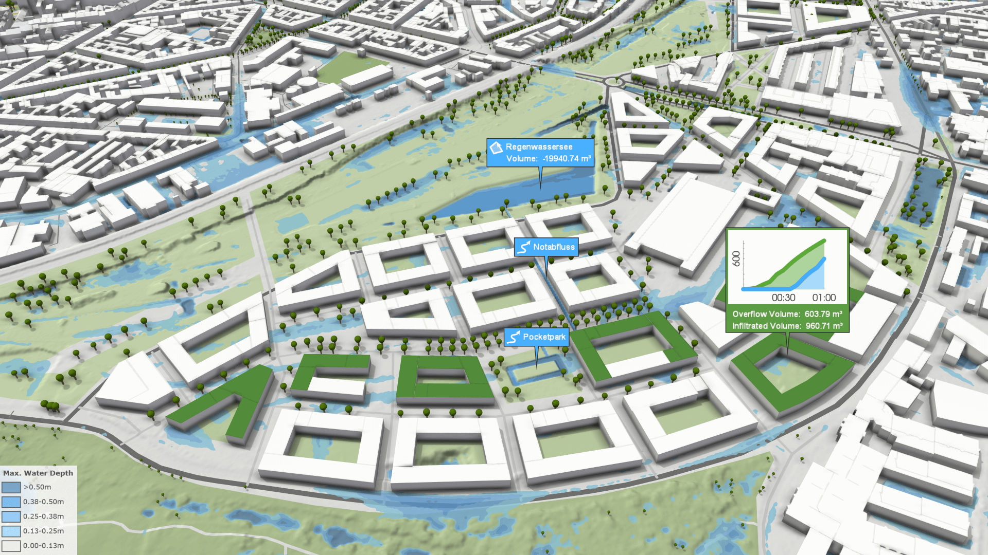
Especially cities and municipalities suffer from the consequences of climate change: heatwaves alternate with extreme weather events such as heavy rainfall and floods. Although climate change is a global problem, local interventions in urban areas, in particular, have great potential for rapid relief. The increasingly frequent and heavy rainfall can not only be tamed by innovative urban development concepts like Sponge City but also be made productive. With our unique digital simulation and visualization application viscloud, we solve real problems caused by too much water. Often, even simple measures such as green roofs or rainwater-fed biotopes improve the situation.
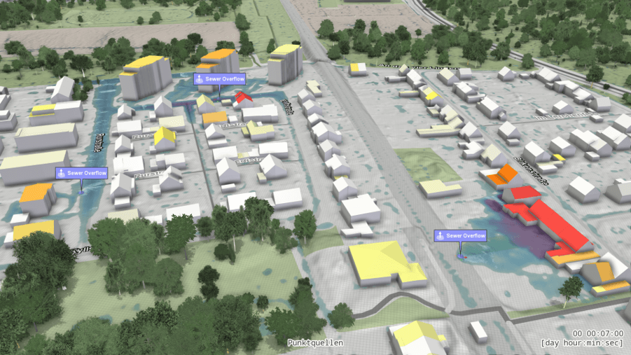
One of the most negative effects of the climate crisis is an increase in flood disasters as a result of heavy rainfall events. For this reason, it is essential for cities and municipalities worldwide to be able to get a precise understanding of which infrastructure is particularly at risk and which structural or landscape planning precautions should be taken, for example, to avert flooding. Our simulation software viscloud offers the ideal support for this: digital twins of entire cities and regions are created from real data, in which all kinds of extreme weather scenarios can be simulated at speeds previously unheard of on the market. This makes it possible to digitally determine the most suitable measures - from constructional modifications to the most suitable locations for protective barriers, to the best evacuation routes - and, based on this information, to decide which solutions will be implemented in real life.
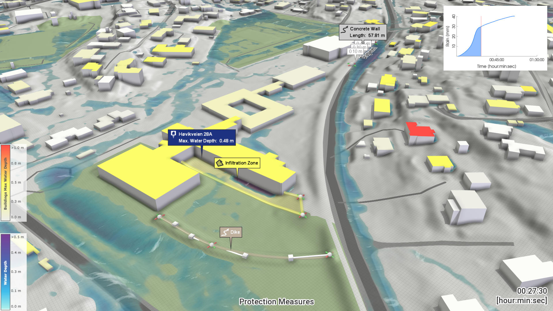
Even the best prognosis cannot prevent the event from occurring, but it can help considerably to get an idea of the extent and scope of a storm or flood. Flood warnings have a long tradition in Austria, in the last century fast riders informed the public when river levels rose alarmingly and cities were acutely threatened by flooding. Today's state-of-the-art flood protection includes precise flood prediction. We can carry out these project-related or based on any GIS coordinates. This is important, for example, for personalised forecasts, but also for marine navigation.
To make cities and regions more resilient, i.e. more resistant and robust against floods or heavy rainfall, risk analysis is a key element. During a successful risk assessment, weak points are identified, hazard zones are calculated and the risks quantified. In this context, we offer detailed calculations in the micro and macro range for various hydrodynamic events, for small municipalities or large areas, for entire regions or even countries. In addition to the analysis itself, viscloud offers easy-to-understand visualizations, which are ideally suited for preparing the public and emergency personnel for possible extreme weather events in advance.
Our expertise is based on years of joint research and development work with top-class scientific partners and renowned application partners.
SCientific PartneRS: Prof. Günter Blöschl (Ingenieurhydrologie und Wassermengenwirtschaft, TU Wien), Prof. Sebastian Noelle (RWTH Aachen), University of Copenhagen/Department of Geosciences and Natural Resource Management
APPLICATION partneRs: StEB Köln, Stadtentwässerungsbetriebe Köln (AöR), Hamburg Wasser, Oldenburgisch-ostfriesischer Wasserverband, Dahlem, Ministerium für Klimaschutz, Umwelt, Energie und Mobilität Rheinland-Pfalz (MKUEN), Bundesministerium für Landwirtschaft, Regionen und Tourismus (BMLRT), Österreichischer Versicherungsverband, DHI Group, Henning Larsen, , RIOCOM – Ingenieurbüro für Kulturtechnik und Wasserwirtschaft DI Albert Schwingshandl, Dr. Pecher AG
Visual analytics tools are well established in the digitalized industry to ensure efficient and reliable predictive maintenance and real-time performance analysis based on the evaluation of large time series data sets. As a result, visual analytics solutions save costs and time at the highest level in the industry. Used in an environmental context, visual analytics creates a better and deeper understanding of climate change and enables more reliable forecasts. In addition, visual analytics, e.g., of climate and energy data, can make crucial contributions to the development and verification of resilient, data-based responses to the climate crisis, for example, in the energy sector.
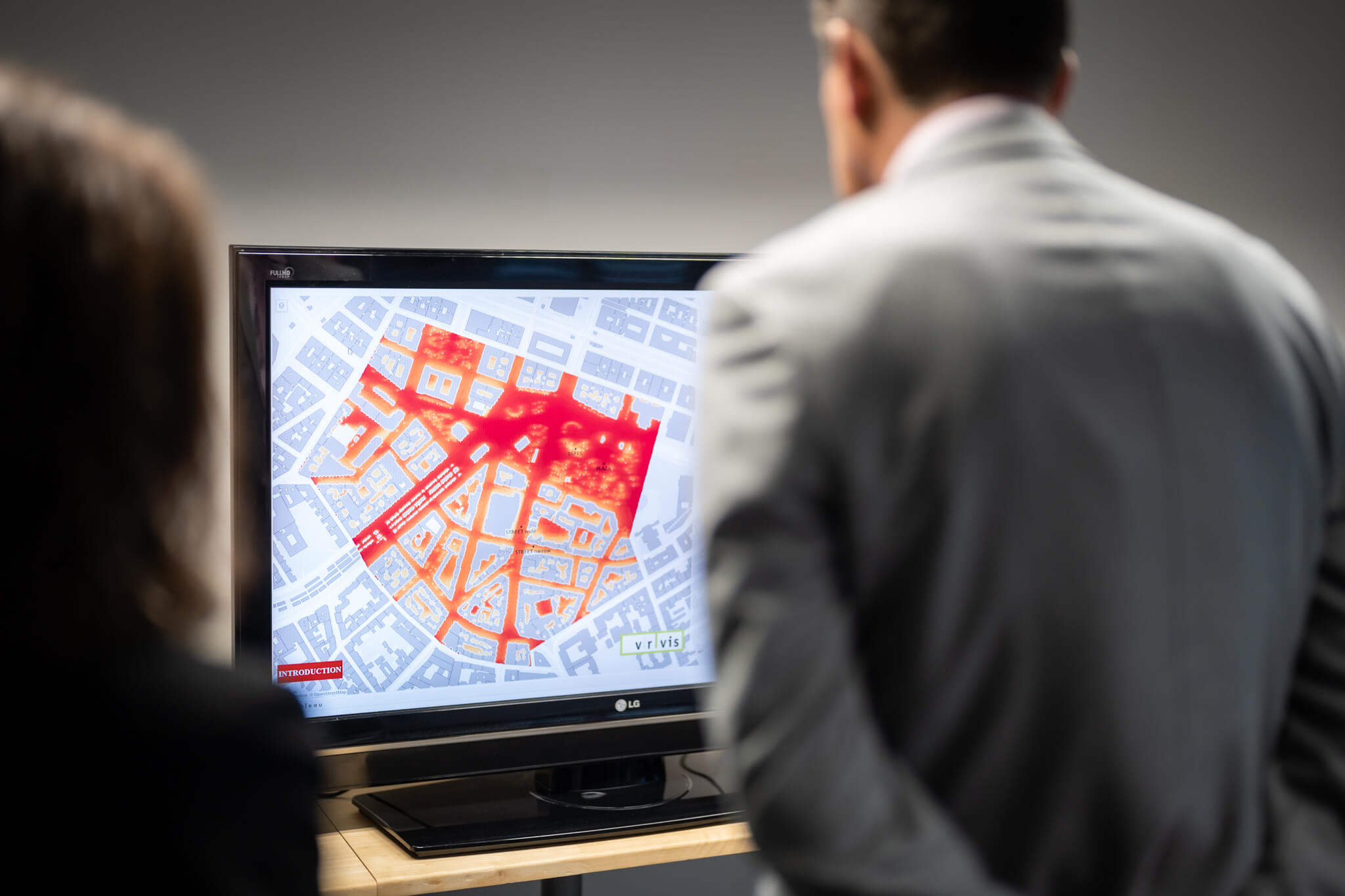
High-resolution meteorological time series data are invaluable for detecting profound changes in the climate system. These data sets allow a comprehensive investigation of warming and cooling trends, the detection of pronounced structural changes and periodic behaviors, and more. For comprehensive as well as user-intuitive analysis of these data, which can include all details such as temperature spikes and contextual outliers, we are developing visual analytics tools combining high-performance processing with web- and cloud-based applications.
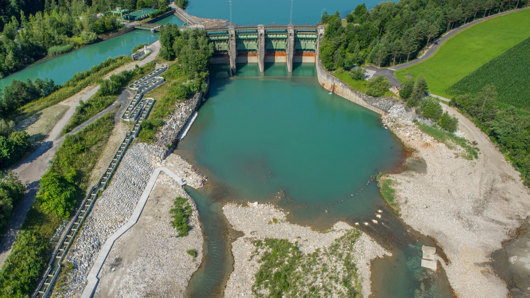
Renewable energies such as hydropower have been the backbone of the energy supply in Austria for many decades. Many hydropower plants are, therefore, of older age and need to be closely monitored and performance optimized to support a green and climate-friendly energy future. Cutting-edge sensors and tailored data analysis systems provide essential tools for real-time monitoring and improved maintenance based on an interactive digital hydropower twin.

Pests and extreme weather affect grain growth and yields. Recording and analysing plant development provides the basis for the prevention of crop losses. VRVis is part of a project consortium developing a platform for agriculture with the aim of using functional imaging data for analysis and teaching skills in training courses.

The ClimaSens project researches efficient and easy-to-access planning tools to enable engagement across different stakeholder groups in the shaping of climate-resilient habitats.

In a research project for Rhineland-Palatinate, VRVis is creating a cooperative digital hydro twin for the German federal state to support the development of protective measures against heavy rain and river flooding.

The cities of the future rely on blue-green infrastructure: the University of Copenhagen, Henning Larsen and VRVis develop a software framework that combines hydrological modeling and 3D visualization for sponge city planning.

Due to climate change, extreme weather events are becoming more frequent and new pests are establishing in agriculture. Together with three project partners, VRVis is developing a digital imaging system for plants that combines information from magnetic resonance imaging and positron emission tomography and detects stress symptoms in plants at an early stage.

On the way to sustainable, climate-neutral cities, the EU project GREENGAGE is developing innovative technology solutions, for better population participation in the issues of mobility, air quality and healthy living.

VRVis develops an interactive viscloud model for the OOWV (Oldenburgisch-Ostfriesischer Wasserverband) for simulating and visualizing regionally differentiated heavy rainfall events for the entire OOWV area.

As part of the research project WiCiD, VRVis is developing an interactive viscloud web application for the city of Gothenburg on behalf of DHI Sweden.

InPlan and VRVis develop a visualization and simulation package for energy planning of buildings, which enables intuitive optimization in terms of energy efficiency and comfort.

A high-resolution base model of the entire federal state of Rhineland-Palatinate makes heavy rain and flood simulations accessible to different user groups.

Within the framework of “AI for Green”-funded research project develops AI-based solutions aimed at optimizing free satellite data for monitoring agricultural areas of all sizes.

With the help of 3D printing (additive manufacturing), spare parts for defective trains can be produced more easily and in a sustainable way as well as faster and cheaper - a great potential for the climate-friendly future of train transport companies.

The Raincloud project's goal is to optimize and extend the simulation software viscloud to tackle the increasing challenges in water planning and disaster management in the face of climate change.

For many years we have been dealing with all aspects of hydrodynamic modelling. With our software viscloud we can model different scenarios and also offer this as a service.

We create a digital twin of a community and simulate weather events to identify high-risk buildings and infrastructure vulnerabilities.

Renewable energies, such as hydropower, are an essential backbone for a climate-friendly future. To enable better real-time monitoring and thus maintenance of hydropower infrastructure, innovative digital hydropower twins are being developed in this project.

The goal of HORA 3D is the development and maintenance of a publicly accessible web application for object-related visualization of the results of the HORA 3 research project.

viscloud's hydrodynamic simulations provide precise water level predictions at any point on a water surface in the "PegelAlarm" app.

Practical flood management with decision software viscloud.

Heavy rainfall events are increasing throughout Europe. In the EU project RAINMAN, VRVis has developed an interactive viscloud model to visualize the course and consequences of possible flood scenarios caused by heavy rainfall for the city of Graz.

Digital representations of the real world and digital twins are becoming increasingly important for planning, situation assessment and decision-making.

The HORA 3 project focuses on flood modelling for all rivers and streams in Austria. The results are detailed flood risk maps for different annual periods.

Decision support system for floods and inundations for the trading district of Shenzen, China.

Flood protection through simulation and visualization: Reducing the effects of floods and communicating measures to the public.