


")


viscloud ist aus über 15 Jahren angewandter Forschung in Kollaboration mit renommierten Partnern wie dem ausgewiesenen Hydrologie-Experten Günter Blöschl von der TU Wien hervorgegangen.
Die viscloud-Software punktet bei ihrer mittlerweile großen Anzahl an Nutzerinnen und Nutzern durch extrem schnelle Simulation auch komplexester und räumlich großer Szenarien, der integrierten und ansprechenden 3D-Visualisierung - und der Kombination dieser und weiterer Komponenten in nur einem leicht verständlichen und bedienbaren Setup. viscloud ist seit einigen Jahren sowohl in Österreich als auch weit über die Landesgrenzen im Bereich Hochwasser- und Starkregenschutz höchst gefragt und dient in einer großen Reihe an Forschungsprojekten als Planungsbasis für die Katastrophenschutzpläne von Städten und Gemeinden. viscloud liefert dabei maßgeschneiderte Lösungen für Katastrophenschutzpläne, bauliche Maßnahmen zum Hochwasserschutz oder für die Erstellung von Evakuierungsplänen, die in bereits über 75 österreichischen Gemeinden und Regionen sowie in deutschen Bundesländern und Großstädten einen wichtigen Beitrag zum Kampf gegen extremwetterbedingte Wassermassen leistet. Darüber hinaus hat das VRVis im Auftrag des Bundesministeriums für Landwirtschaft, Regionen und Tourismus mit viscloud die Hochwasserrisikozonierung für ganz Österreich durchgeführt.
Head of Integrated Simulations Group, Integrated Simulations
waser(at)vrvis.at +43 1 908 98 92 509


viscloud ist das Entscheidungsunterstützungstool, um die Folgen von Extremwetterereignisse bereits im Vorfeld zu verhindern oder im Akutfall schnell evaluieren zu können, was getan werden muss. Darüber hinaus zeigt sich immer deutlicher, dass viscloud auch im Bereich der hochwassersensiblen Stadtgestaltung, wo neue Konzepte wie Sponge City und blau-grüne Infrastruktur urbane Strukturen gegen die Folgen der Klimakrise rüsten sollen, das ideale Entscheidungsunterstützungstool darstellt.
Wichtigste Software-Eigenschaften:
Verwendete Daten:
Im Rahmen der hydrodynamischen Modellierung schafft viscloud dabei einen digitalen Hydro-Zwilling, bei dem eine Reihe von verschiedenen Daten und Datenquellen automatisch eingepflegt werden:
Starkregen
Evakuierungsszenarios
Kanalnetzkopplung
Sponge City
Design von Maßnahmen zur Klimawandelanpassung
Planung blau-grüner Infrastruktur
Hochwasser
Schutzmaßnahmen bei Dammbruch
Stadtentwässerungsbetriebe Köln, Hamburg Wasser, Oldenburgisch-ostfriesischer Wasserverband, Dahlem, Ministerium für Klimaschutz, Umwelt, Energie und Mobilität Rheinland-Pfalz (MKUEM), Bundesministerium für Land- und Forstwirtschaft, Regionen und Wasserwirtschaft, Österreichischer Versicherungsverband, DHI Group, Henning Larsen, RIOCOM – Ingenieurbüro für Kulturtechnik und Wasserwirtschaft DI Albert Schwingshandl, Dr. Pecher AG, University of Copenhagen/Department of Geosciences and Natural Resource Management

Die Simulationssoftware viscloud ist Träger des Qualitätszertifikats des Standardreferenzverfahrens "Starkregengefahrenkarten" des Bundeslandes Baden-Württemberg und erfüllt damit alle Qualitätsanforderungen zur Erstellung von Gefährdungsanalysen und Starkregengefahrenkarten des deutschen Bundeslandes.
Wir arbeiten mit inländischen und ausländischen Unternehmenspartnern in Grundlagenforschungsprojekten, aber auch in anwendungsorientierten Projekten zusammen. Lizenzinformationen sowie Informationen über die Zusammenarbeit an einem gemeinsamen Forschungsprojekt mit viscloud sind auf Anfrage erhältlich. Kontaktieren Sie uns!

Das VRVis-Projekt Visdom auf Basis der Software viscloud gewinnt den renommierten internationalen Nachhaltigkeitspreis WSA 2022 in der Kategorie "Smart Settlement & Urbanization".

Die Simulationssoftware Visdom wurde in der Kategorie "Smart Settlement & Urbanization" mit dem renommierten Change-Maker-Award WSA Austria ausgezeichnet.

Die VRVis-Simulationssoftware viscloud wurde mit dem Energy Globe Award, Kategorie Wasser, ausgezeichnet.

Die VRVis-Simulationssoftware Visdom wurde dieser Tage sowohl für den WSA Austria Award, Kategorie Nachhaltigkeit, als auch für den Energy Globe Award, Kategorie Wasser, nominiert.
Daniel Cornel, Forscher in unserer Integrated Simulations-Gruppe, wurde in der Kategorie Uni/FH für den TÜV Austria Wissenschaftspreis 2020 nominiert.

VRVis und SOBOS überzeugen mit neuer Vorhersagelösung für Wasserstände in Flüssen bei der IÖB-Challenge der viadonau.

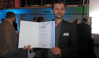
Die Auszeichnung des Best Paper Award der EuroVis 2019 geht an Daniel Cornel.
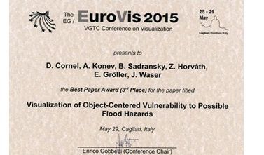
VRVis erhält 3. Platz beim Best Paper Award für das Paper "Visualization of Object-Centered Vulnerability to Possible Flood Hazards".
Das Projekt "Visdom - Visuelle Aktionsplanung im Hochwassermanagement" wurde mit dem Innovationspreis der Wirtschaftskammer Wien ausgezeichnet.

In einem Forschungsprojekt für Rheinland-Pfalz erstellt das VRVis einen kooperativen, digitalen Zwilling für das deutsche Bundesland, um die Entwicklung von Schutzmaßnahmen gegen Starkregen und Flusshochwasser zu unterstützen.

VRVis entwickelt für den Oldenburgisch-Ostfriesischen Wasserverband (OOWV) ein interaktives viscloud-Modell zur Simulation und Visualisierung regional differenzierter Starkregenereignisse für das gesamte Verbandsgebiet.

Die Städte der Zukunft setzen auf blau-grüne Infrastruktur: Die Uni Kopenhagen, Henning Larsen und VRVis setzen auf das viscloud-Software-Framework, welches hydrologische Modellierung und 3D-Visualisierung zur Schwammstadt-Planung vereint.

Im Rahmen des Forschungsprojekts WiCiD entwickelt das VRVis im Auftrag von DHI Schweden eine interaktive viscloud-Webanwendung für die Stadt Göteborg.

Die Zertifizierung des Projektpartners DAHLEM durch das Land Baden-Württemberg zeigt hohen technischen Qualitätsstandard der für Starkregengefahrenkarten genutzten Simulationssoftware Visdom.

Ein hochaufgelöstes Basismodell des gesamten Bundeslandes Rheinland-Pfalz macht Starkregen- und Hochwassersimulationen für verschiedene Nutzergruppen zugänglich.

HORA 3D eröffnet als weltweit einzigartige objektbezogene 3D-Visualisierung von Hochwasserrisiken neue Möglichkeiten der Klima- und Risikokommunikation für die breite Öffentlichkeit.

Im Projekt Raincloud wird die Simulationssoftware viscloud zur Bewältigung der sich mehrenden Herausforderungen in der Wasserplanung und dem Katastrophenschutzmanagement angesichts des Klimawandels optimiert und erweiter.

Seit vielen Jahren befassen wir uns mit allen Aspekten rund um hydrodynamische Modellierung. Mit unserer Software viscloud können wir Hydro-Zwillinge modellieren (Starkregen, Hochwasser) und bieten dies auch als Service an.

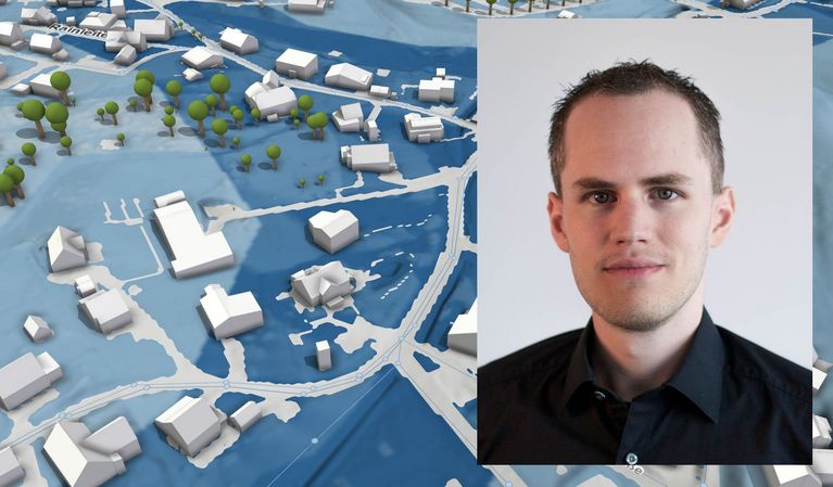
Wir erstellen einen digitalen Hydro-Zwilling einer Gemeinde und simulieren Wetterereignisse, um gefährdete Gebäude und Infrastrukturschwachstellen zu finden.

Die hydrodynamischen Simulationen von viscloud ermöglichen in der App "PegelAlarm" punktgenaue Wasserstandsprognosen an beliebigen Punkten einer Gewässeroberfläche.

Das Projekt HORA 3 konzentriert sich auf die Hochwassermodellierung für alle Flüsse und Bäche Österreichs. Das Ergebnis sind detaillierte Hochwasserrisikokarten für verschiedene Jährlichkeiten.

Praktisches Hochwassermanagement mit der Entscheidungssoftware viscloud, welche Hochwasser- und Starkregenereignisse simuliert und visualisiert.
")
Starkregenereignisse nehmen in ganz Europa zu. Im EU-Projekt RAINMAN hat das VRVis ein interaktives viscloud-Modell zur Visualisierung von Verlauf und Folgen von möglichen Hochwasserszenarien durch Starkregen für die Stadt Graz entwickelt.

Entscheidungsunterstützungssystem für Hochwasser und Überflutungen für den Handelsbezirk Shenzen, China.

Hochwasserschutz durch Simulation und Visualisierung: Minderung der Auswirkungen von Überschwemmungen sowie Kommunikation von Maßnahmen an die Öffentlichkeit.

Die Simulationssoftware Visdom wurde für die hydrodynamische 2D-Modellierung der March- und Donauregion eingesetzt.
")


