
When it comes to flood protection, the city of Vienna is internationally known as very progressive. The areas of Neue Donau and Donauinsel, now Vienna´s largest recreational area on the waterfront, are the centerpiece of the city´s flood protection for the Danube. The reason for the construction of the Donauinsel and Neue Donau were several floods and high tides that repeatedly submerged parts of the districts Leopoldstadt and Brigittenau. The straightening of the Danube at the end of the 19th century was also one of the major projects realized to make the river flood-proof. Since then, flooding in the city due to rising water levels of the Danube has been absent.
Heavy rain can cause problems in the city
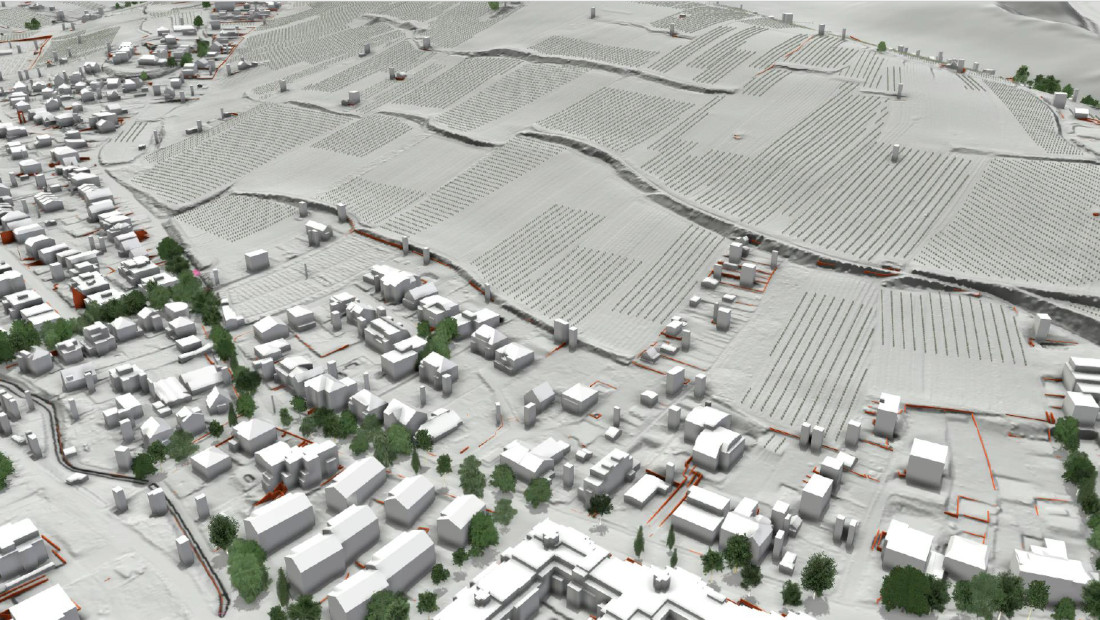
Increasing heavy rainfall is also creating difficulties in the city of Vienna. Extreme weather events are occurring more frequently due to climate change. They are a particular challenge in densely built-up, urban regions, which the MA 45 "Wiener Gewässer" is especially keeping an eye on: Where does the water fall, where does it flow to, and how can it be drained in the best possible way to avoid damage and accidents? For this purpose, the city of Vienna has cooperated with the local water protection experts of RIOCOM. They have set up a high-resolution 3D model of the Viennese regions of Schreiberbach and Nussberg, supported by VRVis. RIOCOM has conducted numerous hydrodynamic simulations of heavy rainfall and flooding for the catchment areas to assess the sewer network and runoff capacities of the 19th district. The runoff capacity of an area is affected by numerous factors, from actual precipitation, to interception of stormwater by vegetation, to soil infiltration, to sewer systems, to the roughness of the surface - all of these aspects affect how and where the rain will flow through the city's streets. Equally, however, the city itself affects the runoff of heavy rainfall: sidewalk edges, buildings, garden walls, fences, or culverts must be considered when modeling a heavy rain event. If all these factors are taken into consideration, the resulting visualization is very close to reality.
Head of Integrated Simulations Group, Integrated Simulations
waser(at)vrvis.at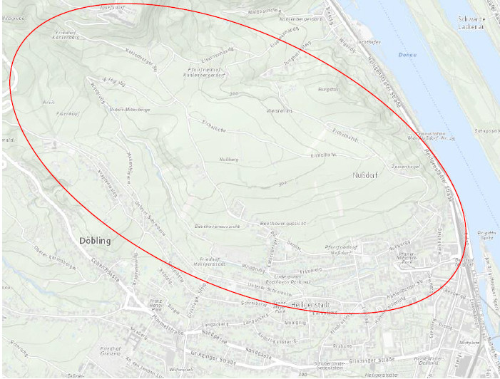
Local pioneering technology
The city of Vienna can rely on one of the internationally most advanced technologies, developed directly in the capital itself. For more than a decade, VRVis, in cooperation with TU Wien as well as RIOCOM and other partners, has been working on a digital tool that can simulate floods, heavy rainfall and inundations of any kind for extremely large areas, at an unprecedented speed. The result is the simulation software viscloud, which is already in use in several countries for flood prevention, disaster management and climate change adaptation. The combination of simulation and visualization as well as analysis in one digital solution makes viscloud indispensable, not only in flood prevention, but also in the development of blue-green infrastructure or the development of Sponge City measures. This is a field the city of Vienna has increasingly relied on in recent years.
3D images as a source for public information
The views and animations of heavy rain events created by viscloud are an important source for the authorities for hazard analysis. At the same time they provide a low-threshold and intuitively understandable basis for information campaigns, aimed at informing the affected population in the context of raising for the topic.
Vienna, 7th June 2023

VRVis develops an interactive viscloud model for the OOWV (Oldenburgisch-Ostfriesischer Wasserverband) for simulating and visualizing regionally differentiated heavy rainfall events for the entire OOWV area.

A high-resolution base model of the entire federal state of Rhineland-Palatinate makes heavy rain and flood simulations accessible to different user groups.

The Raincloud project's goal is to optimize and extend the simulation software viscloud to tackle the increasing challenges in water planning and disaster management in the face of climate change.

For many years we have been dealing with all aspects of hydrodynamic modelling. With our software viscloud we can model different scenarios and also offer this as a service.

We create a digital twin of a community and simulate weather events to identify high-risk buildings and infrastructure vulnerabilities.