


")


viscloud has emerged from more than 15 years of applied research in collaboration with renowned partners like the hydrology expert Günter Blöschl from TU Wien.
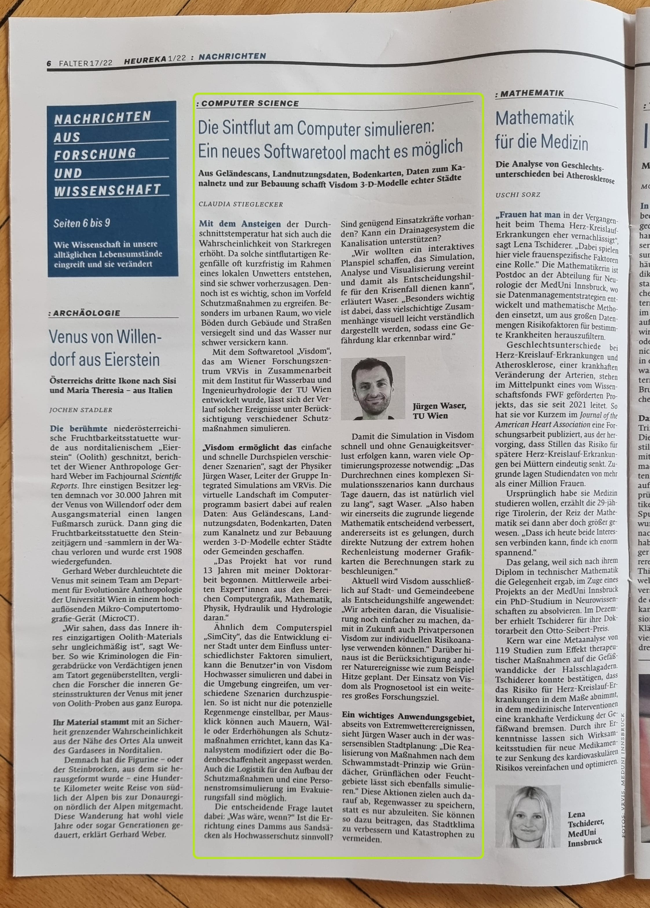
The viscloud software impresses its users with extremely fast simulations of large and complex scenarios, the integrated and visually engaging 3D visualization - and the combination of these and other components in a single, easy-to-understand, and user-friendly setup. viscloud has been in high demand for several years both in Austria and abroad in the flood and heavy rain protection sector and serves as a planning tool for disaster protection plans of cities and municipalities in a large number of research projects. In this context, viscloud provides customized solutions for emergency plans, construction measures to protect against floods, or the creation of evacuation plans, which already makes an important contribution to the fight against extreme weather-related water masses in more than 75 Austrian municipalities and regions as well as in German federal states and major cities. Furthermore, on behalf of the Federal Ministry of Agriculture, Regions or Tourism, VRVis conducted the flood risk zoning for the whole of Austria using viscloud.
Head of Integrated Simulations Group, Integrated Simulations
waser(at)vrvis.at +43 1 908 98 92 509


viscloud is the ultimate decision support tool to prevent the consequences of extreme weather events in advance or to quickly evaluate what needs to be done in an emergency. In addition, viscloud is becoming more and more recognized as the go-to decision support tool also in the field of flood-sensitive urban design, where new concepts such as Sponge City and blue-green infrastructure are aiming to prepare urban structures to face the consequences of the climate crisis.
Key software features:
Utilized data:
viscloud creates a digital twin in the hydrodynamic modeling process, automatically incorporating a range of different data and data sources:
Heavy rain
Evacuation scenarios
Coupled sewers
Sponge City
Design of measures for climate change adaptation
Planning of blue-green infrastructure
Floods
Protection measures for dike breaks
Stadtentwässerungsbetriebe Köln, Hamburg Wasser, Oldenburgisch-ostfriesischer Wasserverband, Dahlem, Ministerium für Klimaschutz, Umwelt, Energie und Mobilität Rheinland-Pfalz (MKUEM), Bundesministerium für Landwirtschaft, Regionen und Tourismus (BMLRT), Österreichischer Versicherungsverband, DHI Group, Henning Larsen, RIOCOM – Ingenieurbüro für Kulturtechnik und Wasserwirtschaft DI Albert Schwingshandl, Dr. Pecher AG, University of Copenhagen/Department of Geosciences and Natural Resource Management

The simulation software viscloud is the bearer of the quality certificate of the standard reference procedure "heavy rain hazard maps" of the German federal state Baden-Württemberg and thus fulfills all quality requirements for the creation of hazard analyses and heavy rain hazard maps of the German federal state.
We cooperate with domestic and foreign corporate partners in basic research projects, but also in application-oriented projects. Licensing information as well as information on cooperation in a joint research project with viscloud is available on request. Please contact us!


The VRVis project Visdom based on the simulation software viscloud wins the renowned international sustainability award WSA 2022 in the category Smart Settlement & Urbanization.

The simulation software Visdom was awarded the prestigious Change Maker Award WSA Austria in the category "Smart Settlement & Urbanization".

The VRVis simulation software viscloud was awarded the Energy Globe Award, Water category.

The VRVis simulation software Visdom is nominated for both the WSA Austria Award, category sustainability, and the Energy Globe Award, category water.
Daniel Cornel, researcher in our Integrated Simulation Group, was nominated for the TÜV Austria Science Award 2020 in the category Uni/FH.

VRVis and SOBOS convince with new forecasting solution for water levels in rivers at the IÖB-Challenge of viadonau.

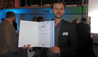
Daniel Cornel receives the Best Paper Award of EuroVis 2019!
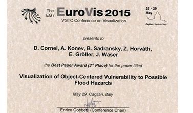
VRVis receives 3rd place at the Best Paper Award for the paper "Visualization of Object-Centered Vulnerability to Possible Flood Hazards.
The project "Visdom - visual flood management action planning" was awarded the Innovation Prize of the Vienna Chamber of Commerce.

In a research project for Rhineland-Palatinate, VRVis is creating a cooperative digital hydro twin for the German federal state to support the development of protective measures against heavy rain and river flooding.

VRVis develops an interactive viscloud model for the OOWV (Oldenburgisch-Ostfriesischer Wasserverband) for simulating and visualizing regionally differentiated heavy rainfall events for the entire OOWV area.

The cities of the future rely on blue-green infrastructure: the University of Copenhagen, Henning Larsen and VRVis develop a software framework that combines hydrological modeling and 3D visualization for sponge city planning.

As part of the research project WiCiD, VRVis is developing an interactive viscloud web application for the city of Gothenburg on behalf of DHI Sweden.

The certification of the project partner DAHLEM by the state of Baden-Württemberg shows the high technical quality standard of the simulation software Visdom used for heavy rain hazard maps.

A high-resolution base model of the entire federal state of Rhineland-Palatinate makes heavy rain and flood simulations accessible to different user groups.

The goal of HORA 3D is the development and maintenance of a publicly accessible web application for object-related visualization of the results of the HORA 3 research project.

The Raincloud project's goal is to optimize and extend the simulation software viscloud to tackle the increasing challenges in water planning and disaster management in the face of climate change.

For many years we have been dealing with all aspects of hydrodynamic modelling. With our software viscloud we can model different scenarios and also offer this as a service.

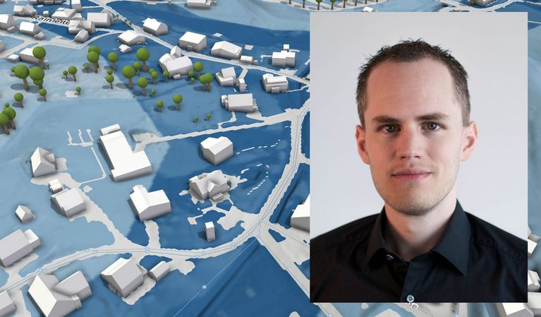
We create a digital twin of a community and simulate weather events to identify high-risk buildings and infrastructure vulnerabilities.

viscloud's hydrodynamic simulations provide precise water level predictions at any point on a water surface in the "PegelAlarm" app.

The HORA 3 project focuses on flood modelling for all rivers and streams in Austria. The results are detailed flood risk maps for different annual periods.
")
Heavy rainfall events are increasing throughout Europe. In the EU project RAINMAN, VRVis has developed an interactive viscloud model to visualize the course and consequences of possible flood scenarios caused by heavy rainfall for the city of Graz.

Practical flood management with decision software viscloud.

Decision support system for floods and inundations for the trading district of Shenzen, China.

Flood protection through simulation and visualization: Reducing the effects of floods and communicating measures to the public.

The simulation software Visdom was used for 2D hydrodynamic modeling of the March and Danube regions.
")

